October 2, 2015
On Friday we had a very good tour of several places in Andalucia that are south of Seville, but north of the Mediterranean. Some of these places have collectively been made famous as the Pueblos Blancos (White Villages). We were in Málaga and Cádiz districts.
Our tour started early. We had to walk over to our 8:00 meeting place in the Plaza Nueva while it was still dark. Our guide, Nestor, picked us up promptly and after we picked up 3 more people we headed south, out of Seville.
Nestor knows a lot and during the day he kept us informed and pointed out things for us to see, and just took good care of us. When he told us things, it wasn’t like he was reciting facts, as some tour guides do, but as if he was telling us stories about things he liked very much. We really enjoyed our time with him.
Our 3 traveling companions for the day were a good, small group to travel with as well. We went in a small van but even that was almost too large for some of the streets we went on.
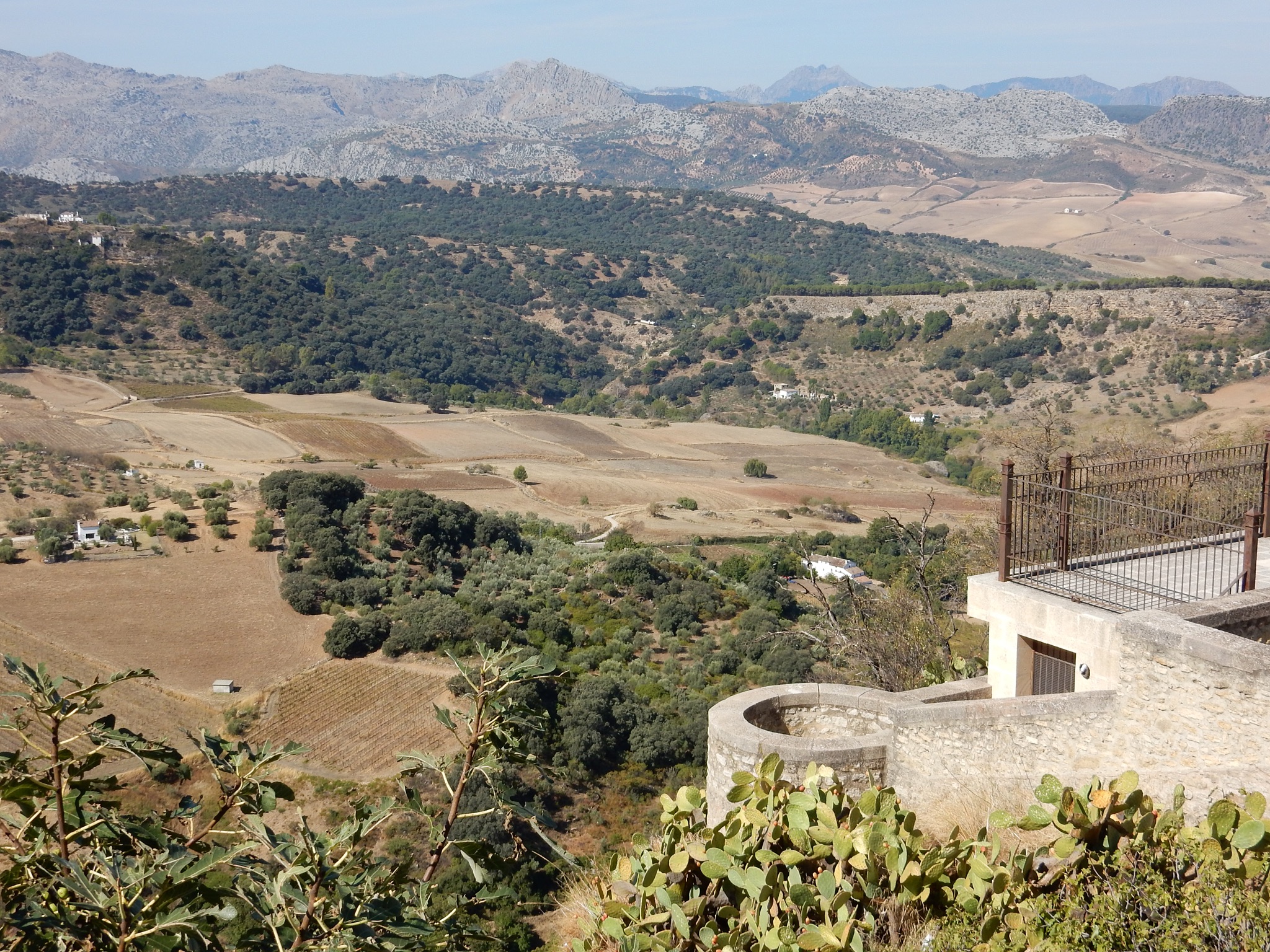
Ronda, our first stop, was about an hour-and-a-half from Seville. Once we got out of the city there was very little traffic. The flat plains around Seville end soon and the land gets hilly, then mountainous. The farmland seemed pretty dry, and the hills seemed very dry with some of the same colors we see in New Mexico. About 30 minutes out of Ronda we stopped at a “venta” which was one of the many small roadside breakfast/snack places one sees all over. Everyone else there was from the local area. We had a typical light breakfast of bread (really good, warm bread) with olive oil and “tomate” which is sort of a tomato paste and is on every breakfast menu we have seen in Andalucia. One does not order cappuccino at these ventas, but cafe con leche (with milk) works.
Ronda is famous for many reasons. For example, it is famous for its bulls and bullfighting and has a bullring that is one of the oldest in Spain (and endorsed, according to a plaque, by Ernest Hemingway). But it is probably most famous for its location and construction.
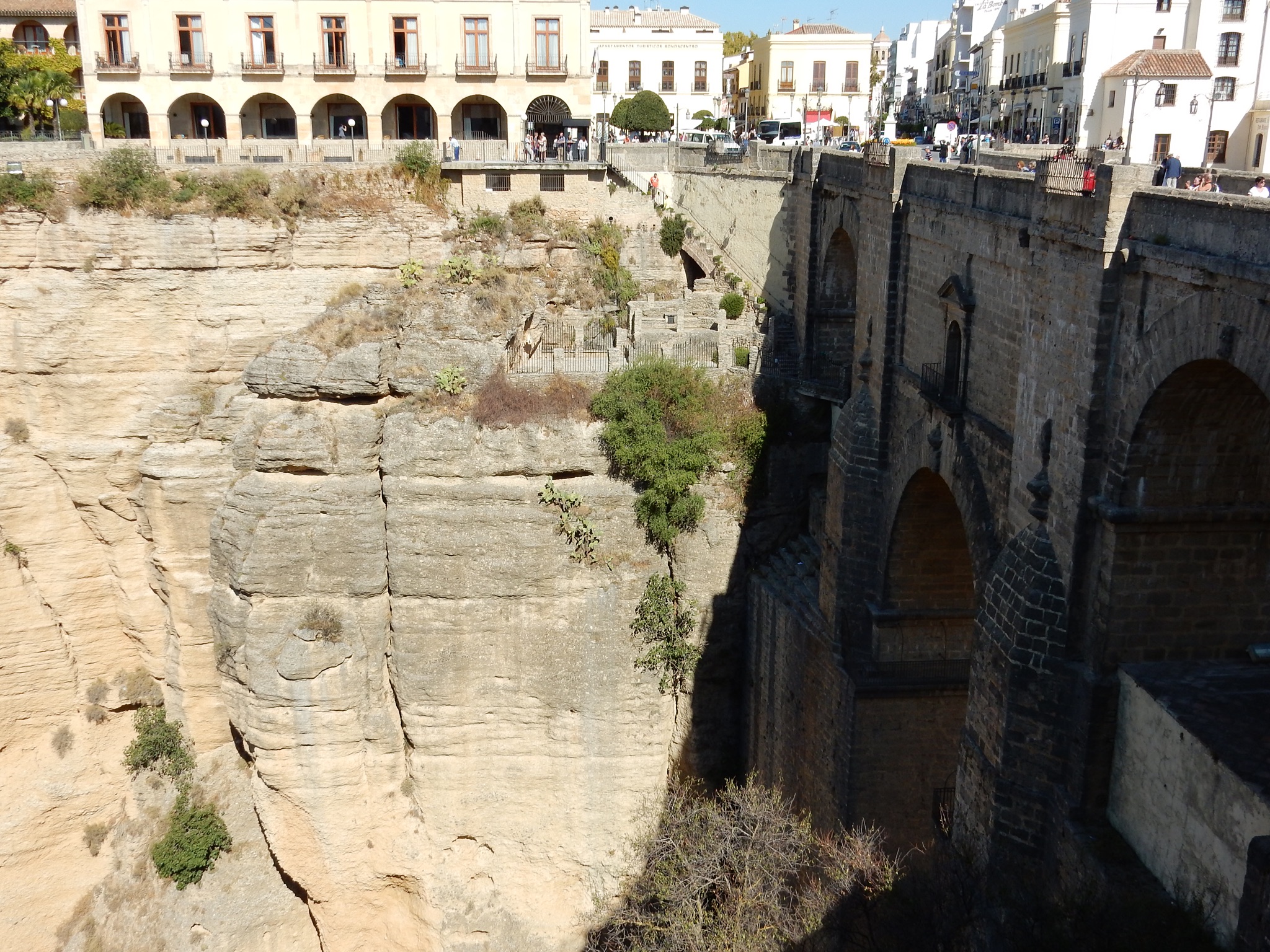
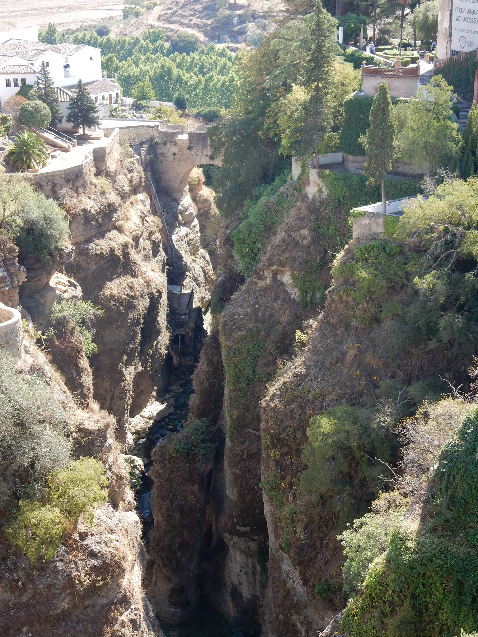
Ronda is in the mountains and is itself located on a couple of large outcroppings which seem like awfully good defensive positions. The early Romans certainly thought so and built a settlement there as long ago as the 5th century B.C. But I have to say that for what looks like a pretty impregnable location, Ronda changed hands more often that I would have thought up until Napoleon’s troops left in the early 1800s. Sheer rock walls protect a couple of sides of the city and a large rift, perhaps 400 feet deep, separates the two parts of the city. Two well-known bridges connect the two parts.
There is the old Roman bridge (no date) and the “new” bridge (Nuevo Puente), which was built around 1750 and is 400 (no mistype) feet high. We walked around a little in Ronda, which attracts many tourists, to several viewpoints and through old streets.

We stuck our heads into one of the old churches-which was built on the site of a mosque-and into several other buildings. It was in Ronda that Nestor introduced us to the famous local pine the Pinsapo. It is the Andalucian regional tree and was used in ships, for example in the ships of Columbus and for the Spanish Armada. It was used so much, in fact, that now there is a large effort to conserve them.
Ronda was interesting and one could easily spend a full day there. We could not, and we headed off for the village of Grazalema.
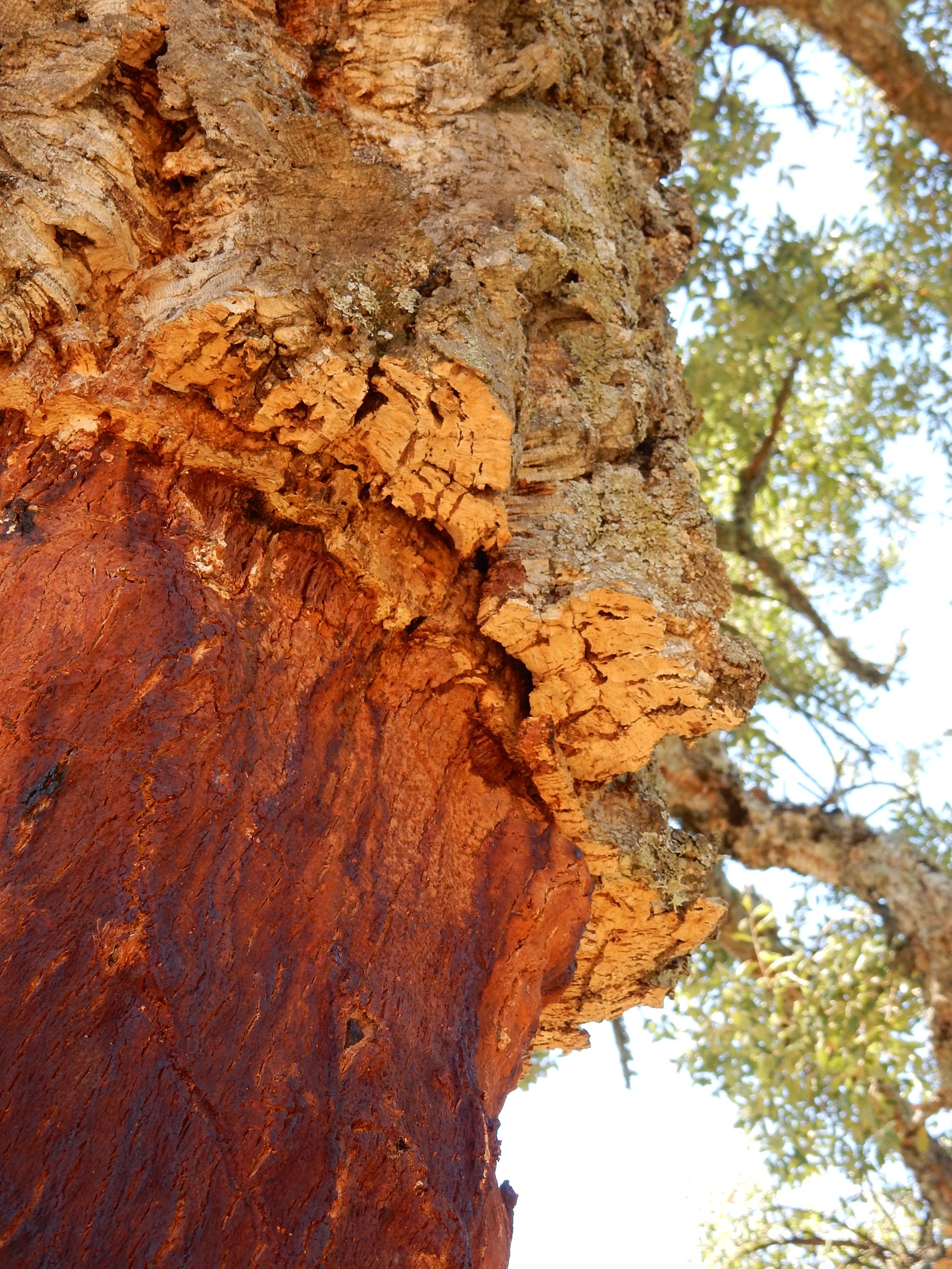
On the way to Grazalema we stopped by the side of the road and got a crash course on cork trees. There are lots of cork trees in the area. Families own the land and the trees but there are small factories that process the bark. the bark is stripped from trees when it is thick enough (about every 9 years) and only up to a certain height. We got some good pictures of some of the stripped trees.
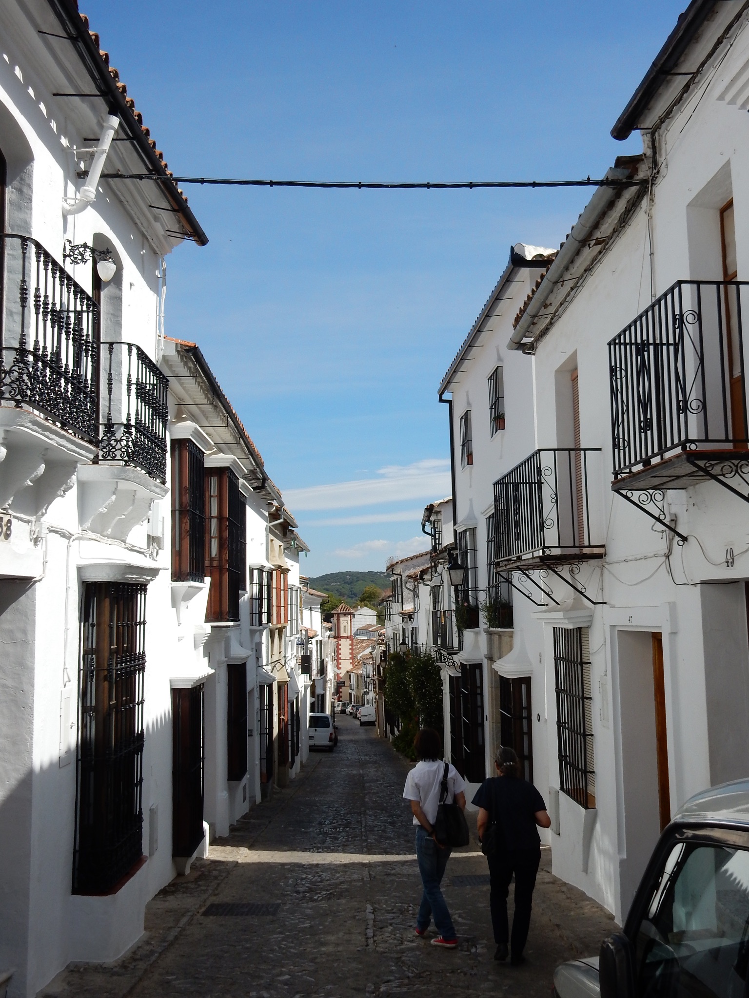
I started out by writing about Pueblos Blancos and now we started seeing some of them. Buildings in Ronda were primarily, but not exclusively, white. As we drove past other villages, often high in the hills, we could see nothing but white buildings. They are painted white, of course, to help keep them cooler in the hot, hot summers. According to Nestor, white is not optional: if you live in one of these places, you WILL paint your house white. I don’t know if it is practicality, the law, or social pressure, but these places were seriously white. And, in most of the places we saw, the buildings were not, mostly, the stand-alone homes that most of us are used to, but were connected in rows along irregular streets, often with a shop on the planta baja (ground floor). In Arcos de la Frontera, our last stop, we saw someone painting their house white with what looked like whitewash, but whitewash with some texture to it. The walls show that texture; not so much that you see brushstrokes, but as lines that give an indication of age.
Grazalema is one of the white villages. We arrived on the day of a historical recreation of the resistance to the French army and Spanish authorities around 1810. This resistance and style of fighting by partisans became known as guerrilla warfare and these people were very good at it. So here the term “bandit” doesn’t have all of negative connotations it does in other places. Some of the streets had been emptied of cars and street signs were covered up to recreate the atmosphere of the early 1800s in Grazalema. Of course, the village is far older than that, so going back a couple of hundred years isn’t that difficult. We ate in a small taberna where we sampled several kinds of local food.
Then we walked up and down some of the streets and took in some of the views from a mirador (lookout). Traffic in Grazalema was a mess because several streets had been closed off for the historical activities. There are about 2,200 residents in Grazalema, which is perched fairly high up. Grazalema was not very touristy. I don’t think we saw a single hotel in the parts we visited.
At this point it was clear that we were way behind any kind of schedule there might have been, but Nestor did not rush us or cut parts of the tour out.
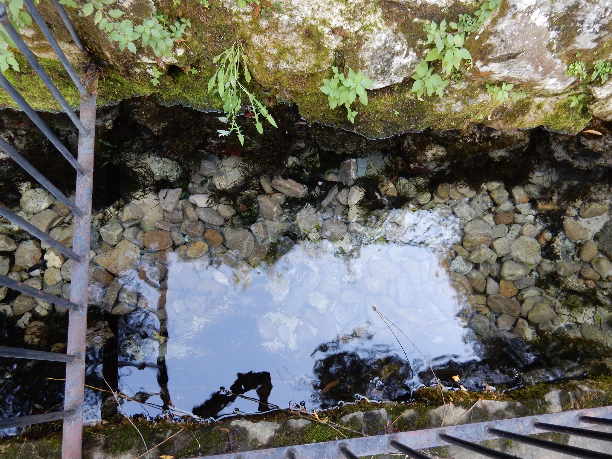
From Grazalema we went to Benamahoma, another white town. The main attraction in this small village–population about 500–was that it offers hiking in the protected pinsapar, the protected pinsapo forest and for its pure spring water at a place called “Nacimiento” (literally “birth”). The water is so clear that when I tried to take a picture of the stream, it showed nothing.
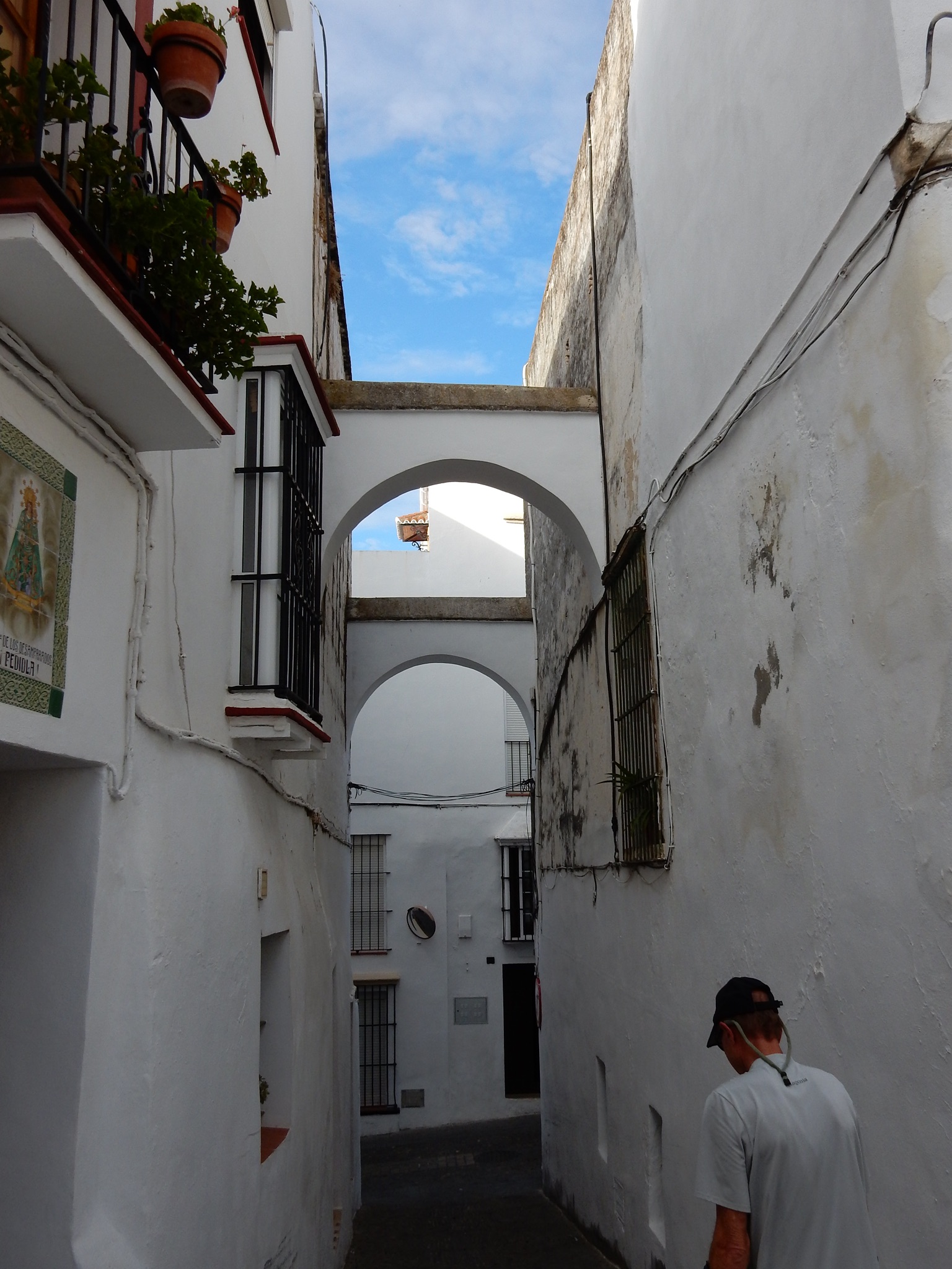
We then drove to Arcos de la Frontera. The town is located near the Guadalete River, which also passed near Grazalema. The “Frontera” (frontier) part of the name is from the town’s location as the 12th-century frontier between the Moors and the Christians. This village is high on top of a limestone ridge and overlooks a lot of farming land. Its streets are narrow and winding and Nestor explained that one reason they are narrow is to create airflow, to help cool the houses.
We stopped at one of the houses where Nestor knows the family. We passed through a large wooden door and through a smaller inner door to a small courtyard. The top of the courtyard was two stories up and covered with an awning that could let in, or keep out, the sun. The courtyard was small, perhaps 20 feet on a side. In combination with the two doors, a draft can be created to bring in some cooler air for the rooms off the courtyard.
Arcos is another old settled location. Its archeology dates back to Neolithic times, and artifacts from many groups since then have been found. On the way into town we saw old caves carved into the limestone.
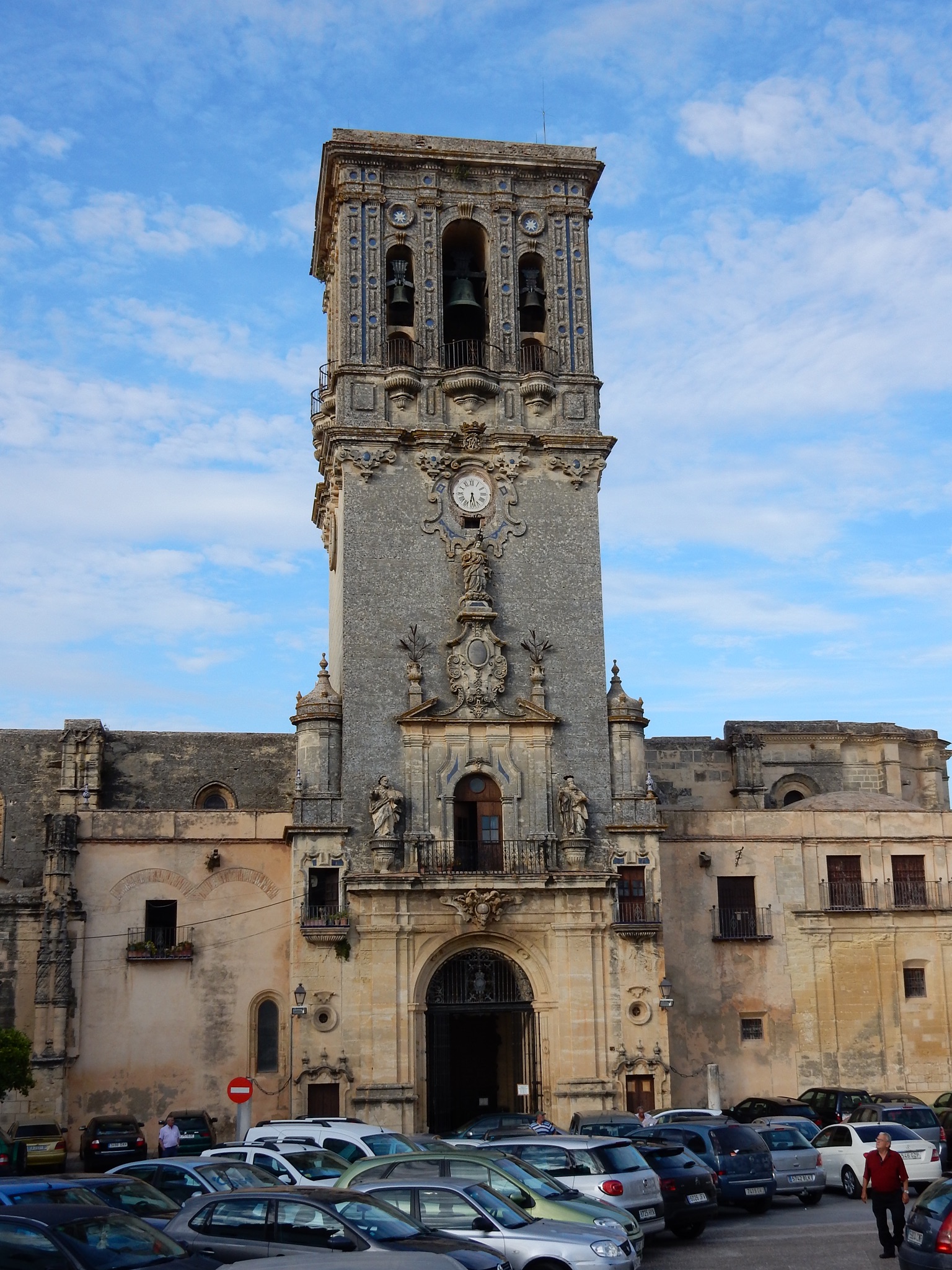
There is a good overlook by the St. Pedro church in what used to be the main square and what is mostly now a parking lot. We could see for miles. Arcos de la Frontera is more than 500 km (320 miles, más o menos) from Lisbon, Portugal. So what? When a massive earthquake hit Lisbon in 1755, it collapsed the roof of the St. Pedro church in Arcos.
The streets are steep, in addition to being winding, so before we headed for a second lookout, we stopped and had a little snack at an outside cafe. Right next to the cafe is a convent of the Mecedarian Nuns. This is a “closed-door” convent which means the nuns have no contact with the outside world. However, they do make and sell biscuits (cookies) to buy some, you go to a small wooden door/window set into a wall. You call your order out to a nun behind the rotating mechanism, put your money on the tray, the door rotates and when it comes back, there is a box of cookies. We got piñon cookies and they were part of our snack at the cafe.
By now it was getting a little bit late, but there was still some light. We headed for Seville, but found more closed streets on the way out of town. Nestor asked a traffic cop for directions and it sounded like there were about 10 steps. It seemed pretty complicated and when we got out of town the roads kept getting smaller, and not larger as I expected. Soon we were on a road that was a little more than a lane and a half wide and cars had to squeeze by carefully. Nowhere did I see a sign indicating that we were headed towards Seville until we had been driving for at least an hour. But Nestor knew where he was going (or got very lucky) and after about 2 hours we were back in Seville–where the traffic was really bad.
Friday night was a special occasion and many of the attractions were open until at least 1:00 in the morning. There were lines of people a couple of hundred yards long to get into some places and thousands of people on the streets. Nestor calmly negotiated the busy streets and returned us to our starting point 13.5 hours after we started.
We had a really good day, but we were so tired that we didn’t even go out for gelato, much less dinner.
I’ll add pictures to the Pictures page soon.