Thursday, October 10th
Driving around the Ring of Kerry
On Thursday, we had what the Irish might call “great” weather: not only was there no rain, there were also long periods of sunshine. [You will remember that “good” weather means no rain. And “no” rain means just intermittent periods of soft rain.]
Despite predictions of a large storm for Thursday night, we saw no signs of bad weather on our drive. If you look at the map with a track of our drive, you will see that we went around the entire peninsula—the Ring.
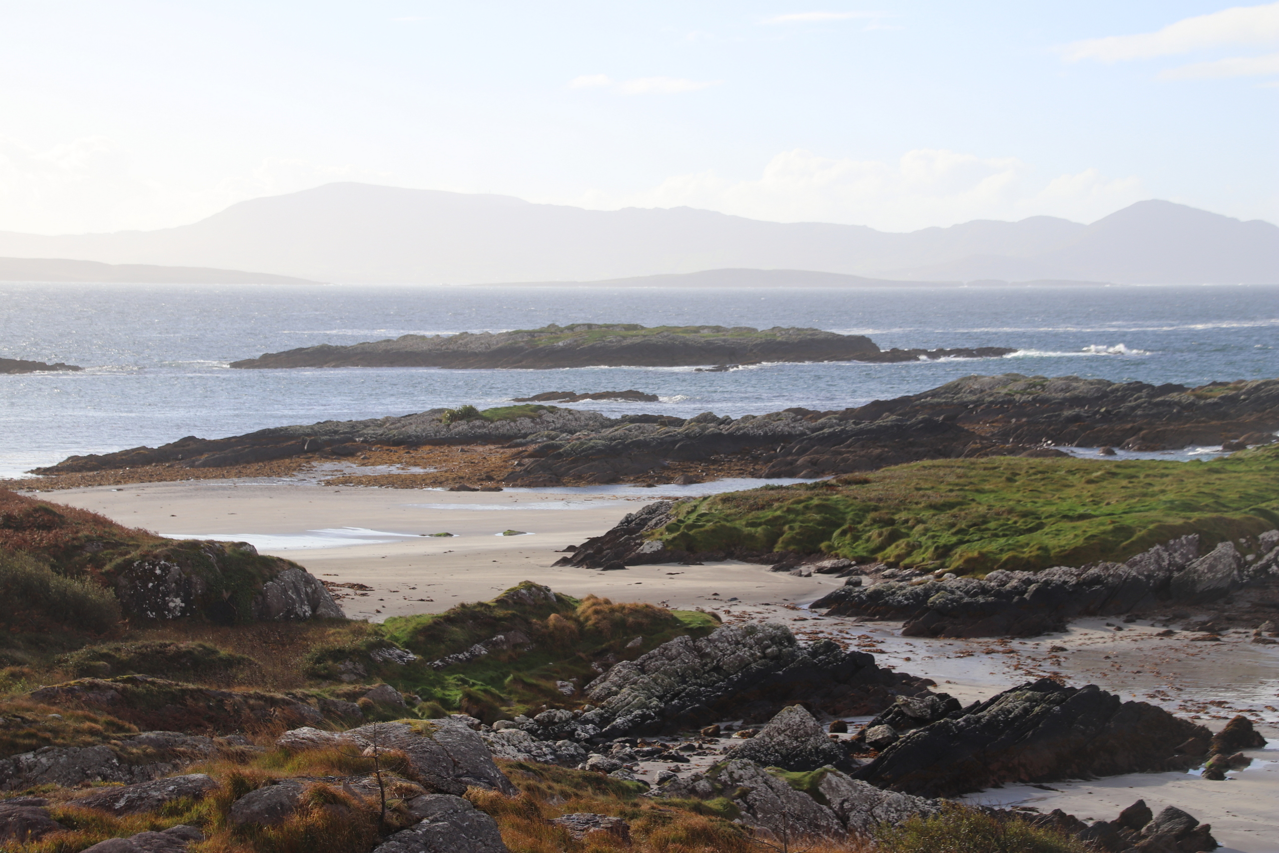
Our first stop was not far past Sneem. We pulled into a roadside lay-by to take pictures of the beach and ocean. The ocean was blue and the tide was out so we could see the rock formations near the shore. On the other side of the road were the typical massive rock outcroppings that dot the hills.
Further down the road we turned inland to visit the Staigue stone fort. Actually, down the road, past the turn, a reversal of direction, and then inland. The “path” to Staigue is called a road—at least partway—but it is at best a lumpy, one-way, narrow, torture test. But it was good practice for the rest of the day. There is an etiquette to determining who will back up when there is two-way traffic on a road that that barely supports one-way traffic. We got to practice that etiquette a lot. And, while it is a 4km (2.5mi) hike from the main road to the fort, there were also several walkers. The walkers provide a special challenge because there is often literally no room on the side of the road for them to step into.
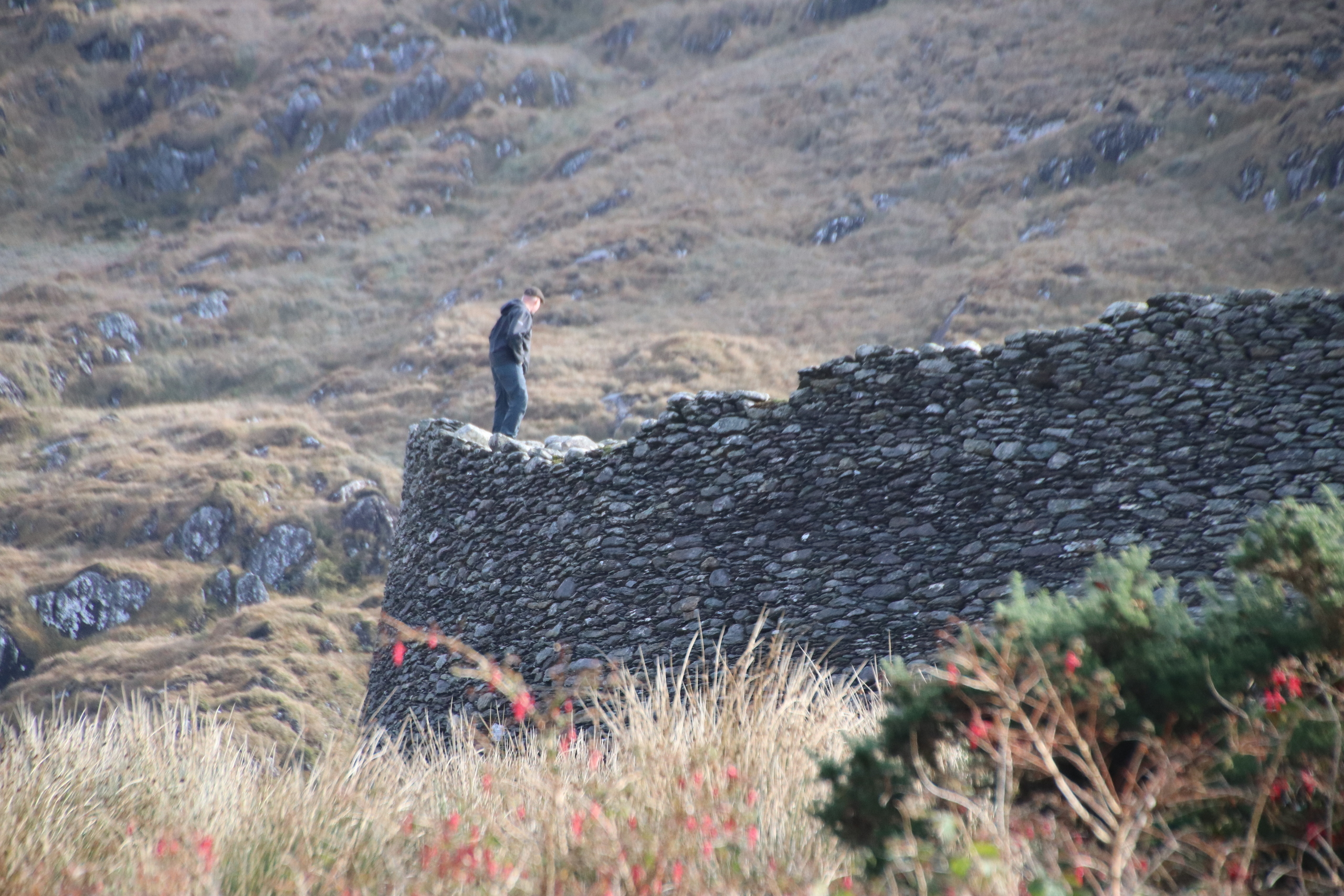
When we visited the fort 8 years ago, we were the only visitors. This time there was a slow but steady trickle of people. The so-called stone forts, which are found all over this part of Ireland, are notoriously difficult to date (usually no organic material, and the building techniques didn’t change much over time), but this one is said to be 1,000 to 1,200 years old. They are always round, but the thickness and height of the walls vary. I would estimate these walls to be 12-15 feet high. The inner surface of the walls, which are built with no mortar/cement, are rough. At several places there are steps and platforms, so the people inside can look over the walls for approaching danger. In this fort, there are what appear to be small caves—they seem to be too low and shallow to be called rooms—but I don’t know if these were for shelter or storage.
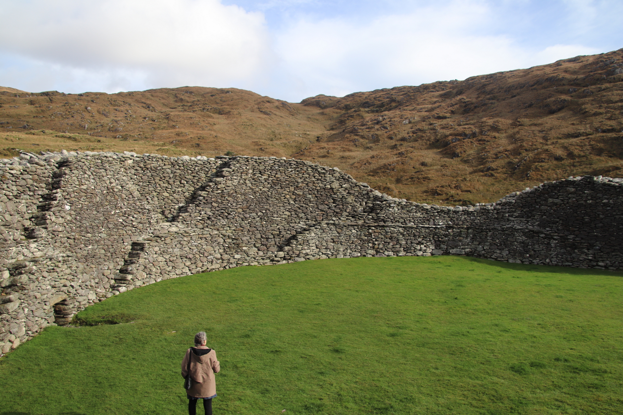
I looked at a satellite map of the area after we got back and discovered that while the area around the fort is green and lush with enough grass for lots of sheep, less than 200 meters in every direction there is a lot of rock (it’s Ireland, after all) that looks barren. Presuming the landscape hasn’t changed all that much in 1,000 years (I know, I’m just guessing) the builders picked the best site around. The theory is that the stone forts were built to protect the “wealth” of the builders. It makes sense that they were wealthy because moving that much rock would have been quite an investment.
After leaving Staigue, we headed for another stone fort: Cahergall. The GPS seemed perfectly confident that it knew the way. [The fact that I drove into a farmyard was my own fault.] Turn right here, left there, 1.1 km, turn left again, 100 meters to your destination. The instructions began to seem less likely as we got closer to the supposed destination. And, sure enough, when we got to the end, we found ourselves on a pier, looking out at a vast mud flat—the tide was out. There was no stone fort in the area. Rats!
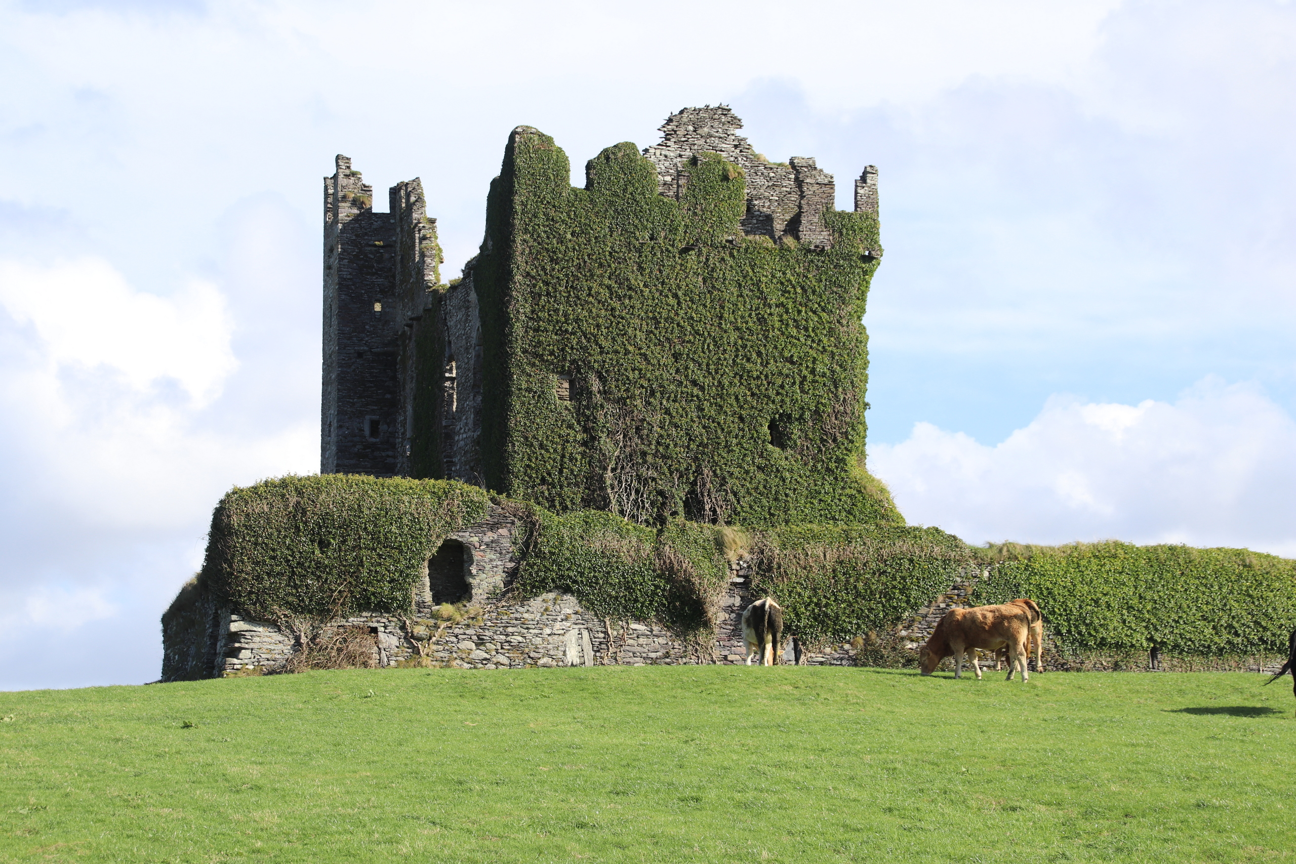
Our next stop was to see the Ballycarbery castle. On the way there, we saw signs for the Cahergall Stone Fort. Wait! That fort should have been on the other side of the inlet if the GPS was right. But no, it was close to the castle. Sure enough, as we got closer the signs kept pointing us to the stone fort and the castle. [There had been no signs on the other side, which, looking back now, should have been a clue.] The only thing I can think of is that the pier was meant to be a ferry connection because the straight-line distance between the fort and pier was not great—just water and bud flats between.
Nevertheless, Cahergall Stone Fort was well worth the additional trouble. When we got there, Patricia headed up the path and someone popped out from behind a truck and tried to hand Patricia a sheep to hold. He wanted to charge her for the “privilege.” But she avoided being (wait for it…) “fleeced.”
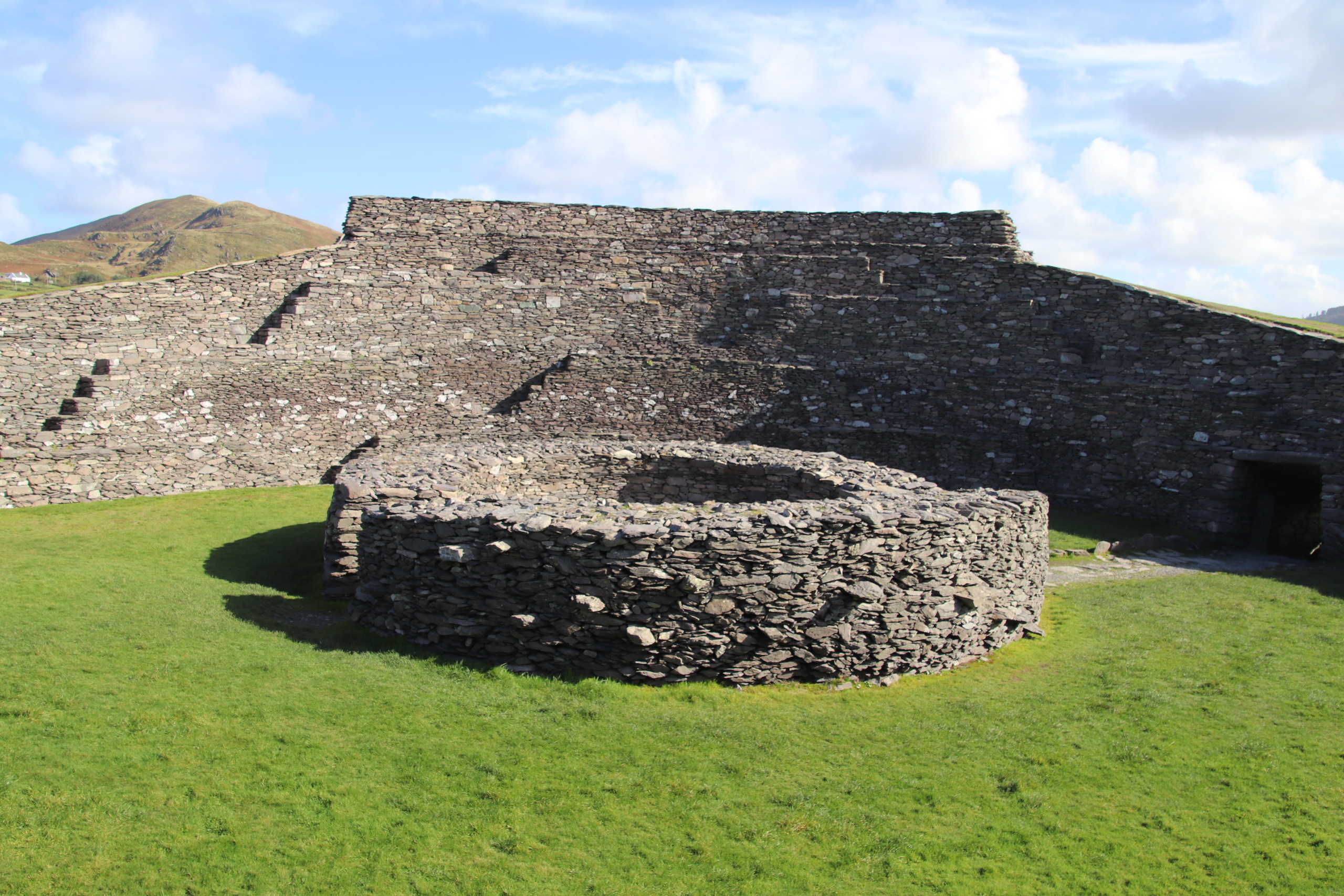
Cahergall’s walls are about 6 meters tall (approx. 20 ft) and 4 meters thick at the base. Its circumference is greater than that of Stigue. In the center of the enclosure is another circular wall, which I presume was another shelter. I climbed the walls, which have blocks that can be used as stairs, to reach the topmost levels so I could see outside and take pictures. The view of the surrounding countryside was good, but I realized that was the ONLY way to see anything outside, so the inhabitants must have had to post sentries either at the top or somewhere outside all the time.
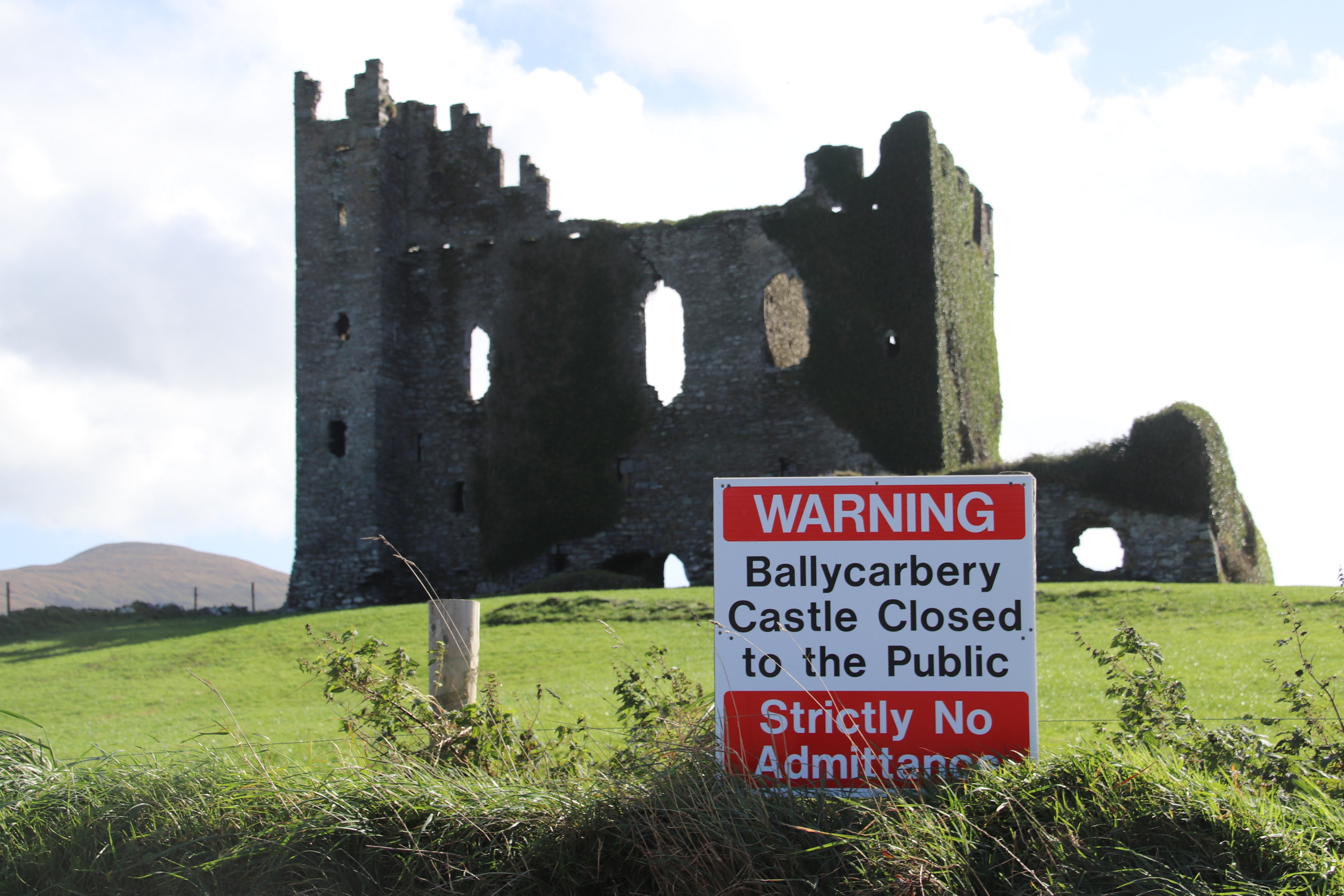
From Cahergall we went a short distance to Ballycarbery castle. The castle stands on a small hill, next to the water and, like most castles around here—to say nothing of churches—has been rebuilt at least once. The current version of the castle dates back to the 1500s. People are not allowed in the castle, or even its grounds. It is clear that it would not be safe. The sun was just wrong for taking pictures so I will have to do some work on them. I did walk around the shoreline (you will remember that the tide was out) and found a place to take pictures of the castle, the green hill, and the cows on the hill.
I wrote about hiking around the shoreline to lead into an easier way to take pictures. When I got back to the car Patricia told me someone was flying a drone. And sure enough, we talked to a young man from Spain who had brought along a drone for the first time on this trip. He could avoid the prohibition about approaching the castle and the inconvenient sun by simply flying his drone up to, and over, the castle. He had some great pictures. He was pretty pleased with how well the drone was working. Patricia thinks there may be a drone in our future.
On the way back we went up the north side of the peninsula, where we stopped several times to take pictures. I know I say it at least once on every trip, but my pictures simply cannot do justice to the landscape. It must be seen directly to be fully appreciated.

We drove through Kilarney, intending to get back to Sneem. Unfortunately, a farmer, with his giant tractor, towing a huge tank of something, had his own ideas about “quickly.” We followed him for some distance through beautiful scenery in the Kilarney National Park. It wasn’t all bad for a while. The tractor took up well over half the road, so we always had warning when there was oncoming traffic because he forced them to the side. The roads are narrow and twisty so it was slow going.
Until…
The tractor met a bus going the other way. They met on a curve where there was barely room for one vehicle, much less two large ones. We, of course, stopped quickly. Traffic piled up behind us and soon there were 20 or so cars behind me. On our left, next to Patricia was a very solid outcropping of rock; can’t move there. On our right was a sheer drop into water; can’t move right. The impasse lasted 15 minutes or so. On the other side, more buses had piled up. The lead bus driver came down to me and said we should all start backing up to someplace where we could pull to the side. A “discussion” ensued when I pointed out that the likelihood of 20 cars backing down a twisty road as other cars were still coming up was slim and that HE should back up. Finally, an inch at a time, the bus and tractor edged past one another and we were able to get underway again. The bus driver, who was also frustrated, told us that there is a protocol that the buses all travel in the same direction (say, towards Kilarney) in the afternoon and that the tractor driver should have known that he should not have been heading out on that side of the road at that time of day.
All part of the adventure of travelling, I guess.
We got back to the Sneem hotel and walked into town. I think ”village” would be a better description, since there is not much in Sneem. Several of the businesses are already closed until next spring. We looked at the 4 restaurants that are still open and ended up having a good meal at the Stone House.
Then back to the hotel, where I finished up the Wednesday post and while we waited for the predicted storm to arrive. Which it did, right on schedule, at 10:00pm. I don’t think we have ever heard such roaring wind. During the night we lost internet, cell service, and the power—for a while until the generator kicked in. As I write this at 11:00 Friday morning, we have decided to brave the elements and head for the Dingle peninsula.