October 14, 2018
The Burren and The Cliffs of Moher
Today’s weather was what the locals call “grand.” It was cool, clear, and no rain. After yesterday, that was a nice change.
We ate breakfast Here at the Temple Gate Hotel. We are glad that we did not include breakfast in our package, because this one, in contrast to most of our other breakfasts, was not very good. It should be easy to find alternatives in Ennis. We have only walked around town a little bit, but there are plenty of places to eat.
Because the weather was so good this morning, we decided to do our trip to the Burren and the Cliffs of Moher while conditions were so pleasant. How nice was it outside? For the first time on this trip, Patricia needed to wear her sunglasses.
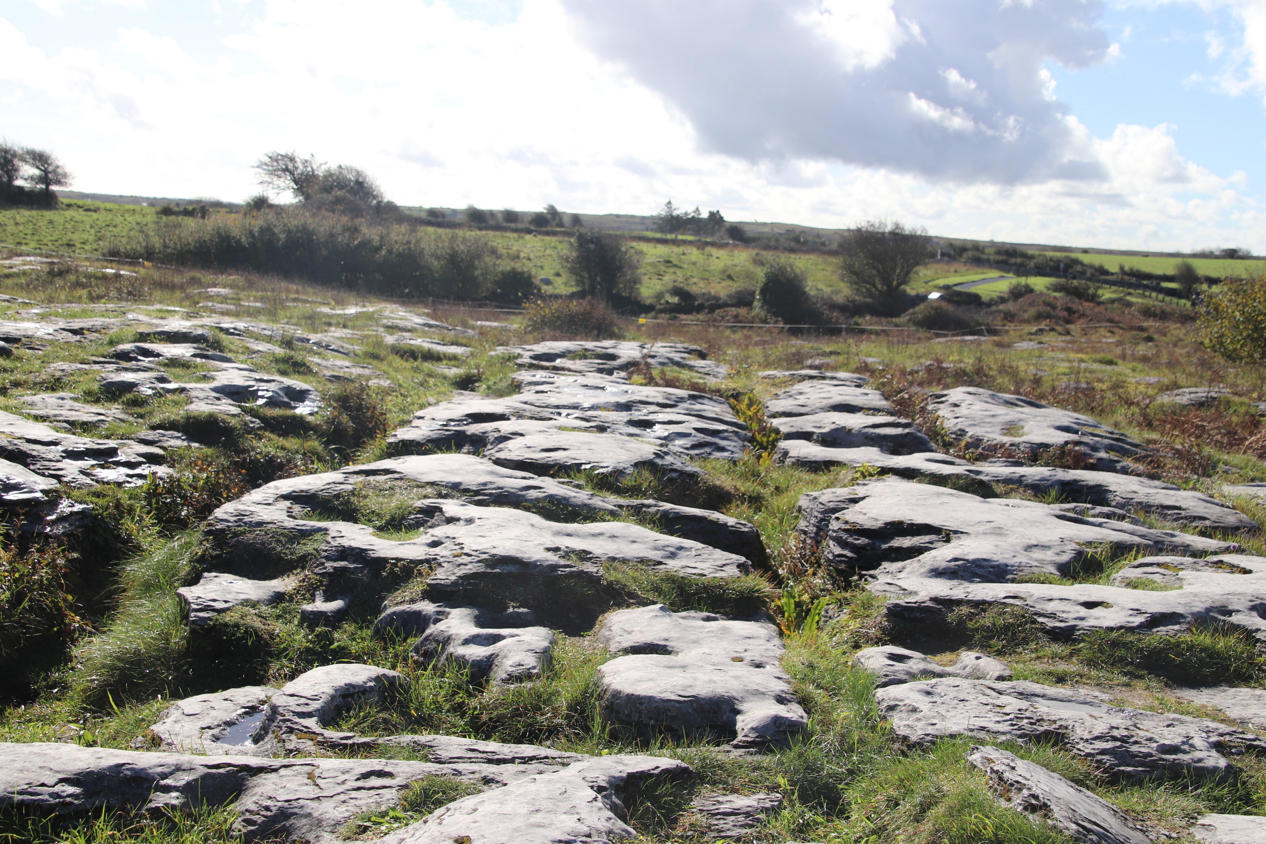
You may have heard of the Cliffs Moher, but perhaps not The Burren. The Burren (locals say something like “byrne) “is one of the finest examples of glacio-karst landscape in the world. The effects of the last glacial period (the Midlandian) are most in evidence, with The Burren overrun by ice during this glaciation.” (Wikipedia) I have struggled with how to describe it because it is unlike anything we have seen before. I thought about saying the ground is solid rock, but, while true, it is not very descriptive. In The Burren National Park (which is just a section of the area) think of a grey sand beach on which someone has pulled a rake to create many parallel lines and then dropped rocks on it to make depressions. Except instead of sand, solid limestone and instead of a rake, thousands of years of water eroding the limestone, and instead of rocks on the sand making depressions, water etching out shapes. Just look at the pictures; perhaps they will help.
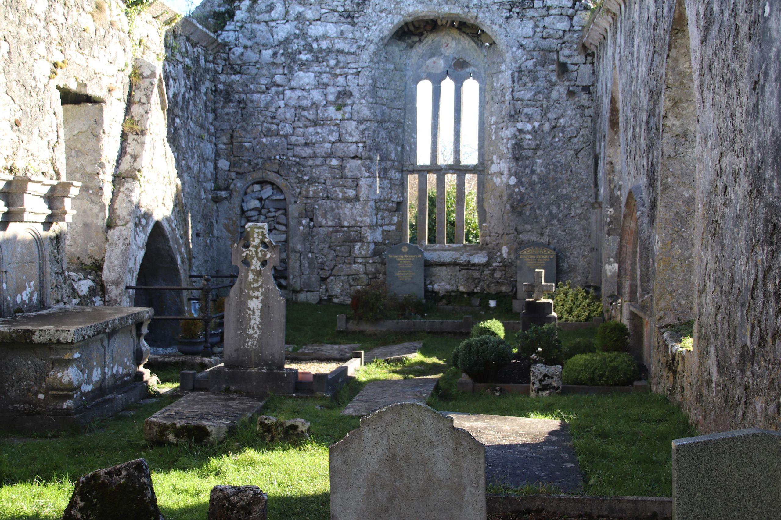
We managed to find our way from the hotel to the area of The Burren with little difficulty. The area around Ennis has many old sites to visit and we had a few on our list. But our first stop was unexpected—in a good way. As we drove on R476 we spotted an old church on a small hill near Killinaboy and decided to stop. We are glad we did. This old church, which dates from the 11th to the 16th centuries. It is on the site of a much earlier church which may date back to the 7th century. On the church grounds are the remains of an 11th century Norman tower—which is only about 14 feet high now. The grounds around the roofless building, which still has all four walls standing, are still used as a cemetery. We wandered around for some time in the wet, green grass looking at the grave markers which are both outside the building and inside the walls. The oldest marker I could read was from 1760, but most of the monuments were from the 20th century.
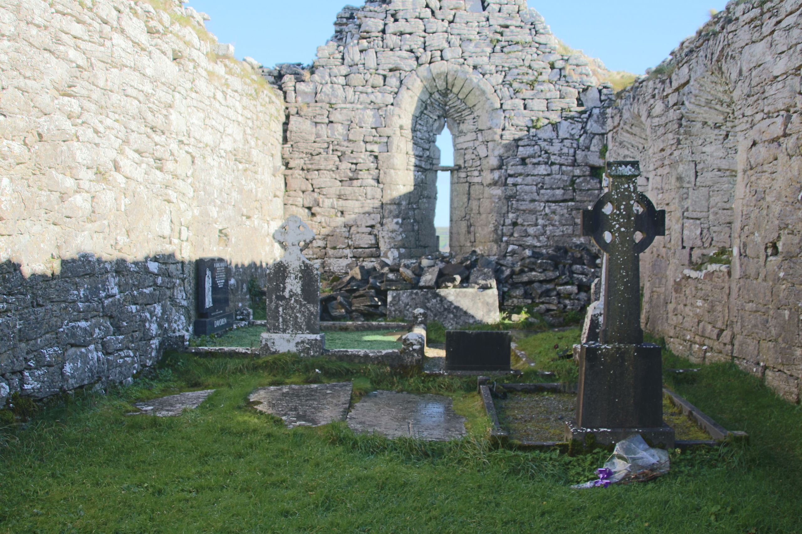
Our “official” destination for this part of the drive was a dolmen (megalithic tomb with a large flat stone laid on upright one) called Poulnabrone, but as we headed in that direction, we saw other ruins in the fields. We next stopped at another church ruin called Carran. This church dates from the 13th to 16th centuries. Not much restoration has been done to it, but there was some interpretive signage on the grounds. These ruins sit near the side of the road and rest above a small valley (“valley” makes it sound bigger than it is). The church is now roofless and is surrounded by many grave markers. Much of what would have been the floor inside the church is also covered with gravestones. Like Killinaboy, these graves were also (mostly) recent. I write “mostly” because many of the stones, inside and outside, have faded away with time as they seem to have been made with the local limestone. Some of the newer memorials are made of marble and not yet faded. Next to the church are some standing stones and cairns (piles of rock), The standing stones, of course, are much older than the church.
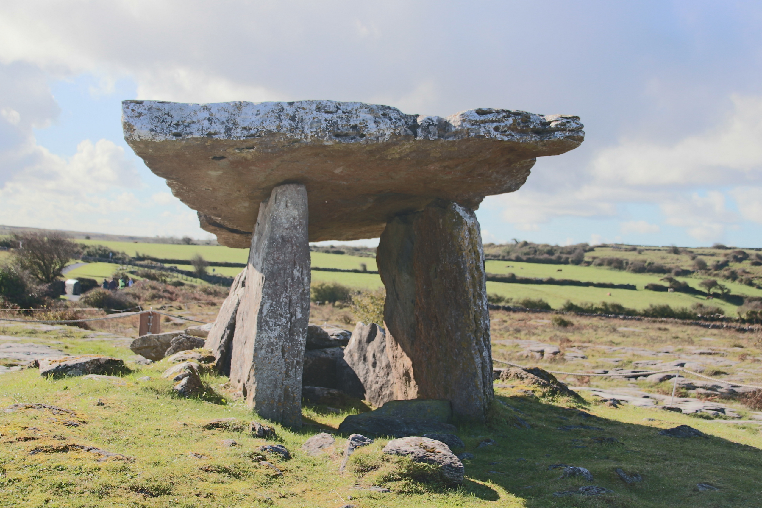
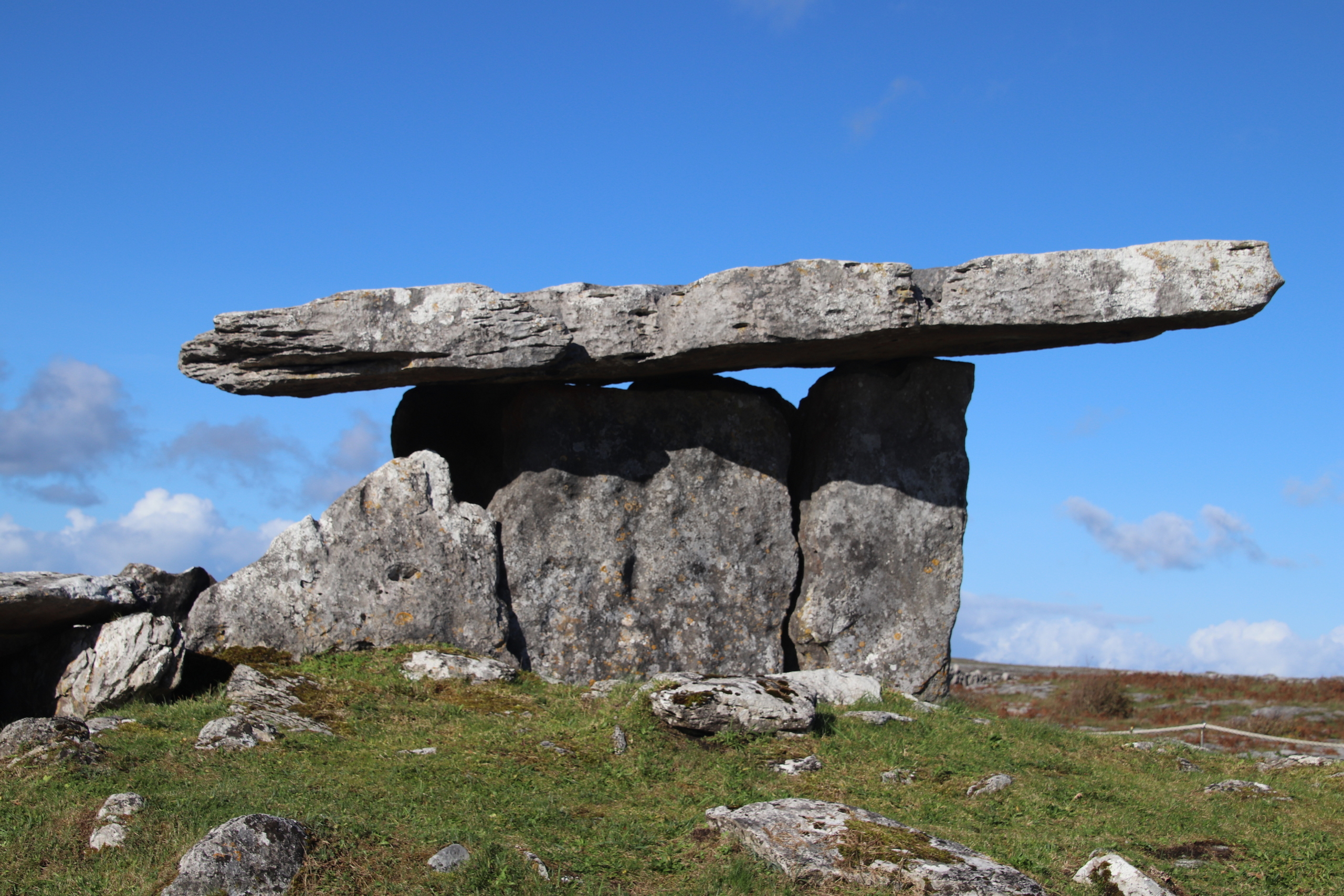
Our next stop was to see the dolmen Poulnaborne. It dates from (about) 4200 to 2900 BCE. Some bodies were found below the dolmen and were dated to between 3800-3200 BCE. This dolmen is situated on the karst (topography formed from the dissolution of soluble rocks such as limestone, dolomite, and gypsum. It is characterized by underground drainage systems with sinkholes and caves-Wikipedia) surface of The Burren and visitors are allowed to walk all over it. The “structure” has vertical supports of rock on two sides and a “cover” or “roof” made of a single slab of rock on top. It is not large and I would have to duck a bit if I tried to stand inside. Fortunately, the entire structure is roped off. Perhaps many people would find it uninteresting or small. But it was erected before Stonehenge and the Pyramids, so it has value from a historical perspective.
The pictures will help.
On to the Cliffs of Moher. The GPS could have taken us to the end of R480, where we would have turned left and driven on to the Cliffs. But no, it did not do that. I think it held sort of an internal discussion with itself and said: they haven’t seen enough one-lane Irish roads yet. So we took the “back way” to the coast. And when I say back way, I mean it. We drove on 5 or six small country tracks that had grass growing in the middle to get to a road which would lead us to the Cliffs of Moher Visitor Centre. It was a very nice drive on such a pretty day.
When we got to the Visitor Center, it was clear why we had not met any oncoming traffic on the small (tiny) roads: everyone else in Ireland was visiting the Cliffs on this sunny Sunday.
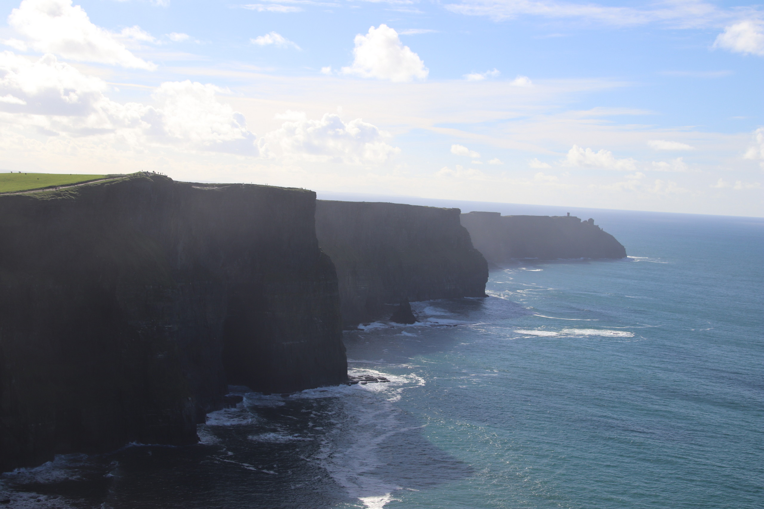
The Cliffs of Moher are the second most-visited Irish tourist attraction-behind the Guinness storehouse. They face the Atlantic Ocean and the top of the Cliffs is about 700 feet above the surface of the ocean—even more, I suppose, when the tide is out, as it was when we visited.
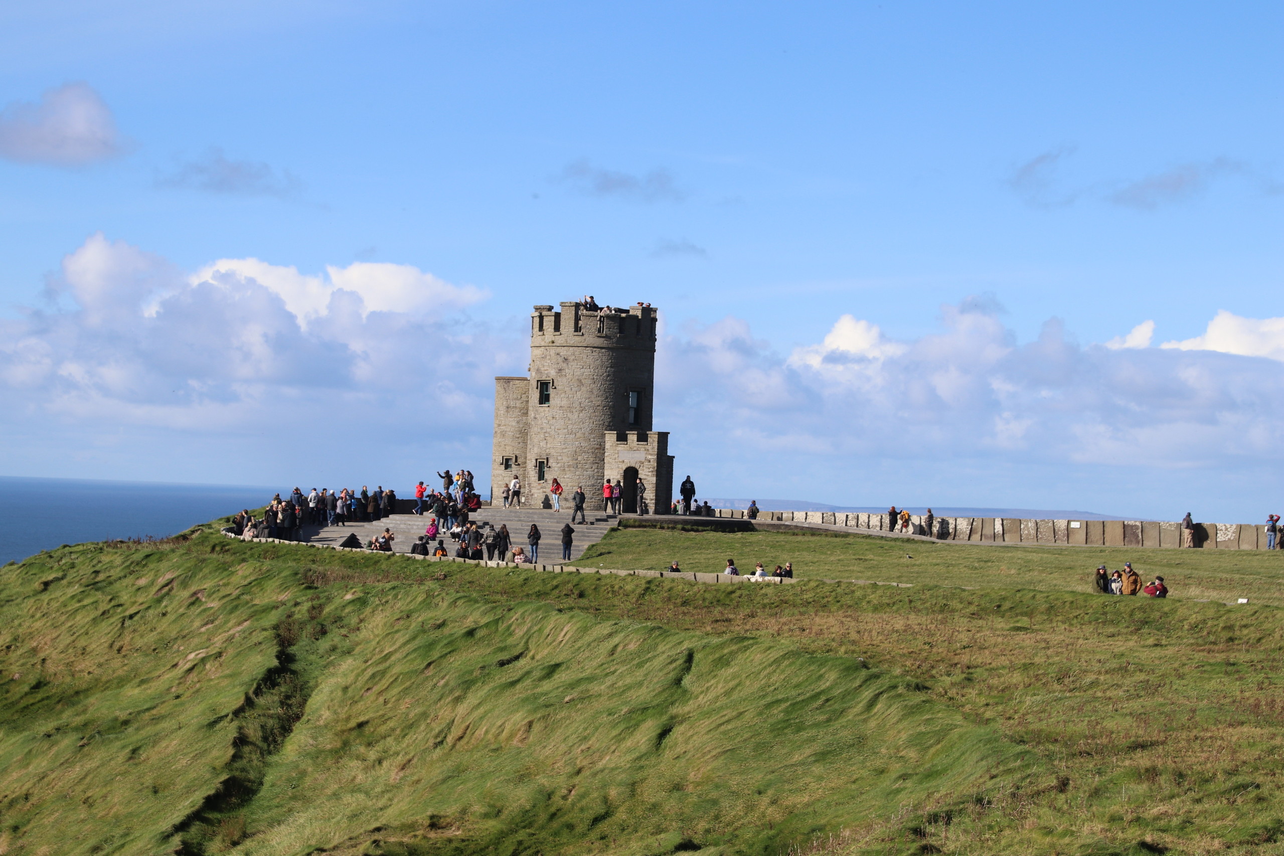
There were tons of tourists (we somehow exempt ourselves from that designation) wandering around the grounds. The “managed” part of the paths along the top of the Cliffs is only about a mile (1.6 km) or so long, but the paths stretch out much further than that. We walked to O’ Brien’s Tower, which is the highest point of the Cliffs and then to the south. I can image that the view changes constantly with clouds and the angle of the sun on the Cliffs. We were there mid-afternoon and that limited my ability to capture a lot of detail as I tried to capture the gigantic landscape. I should mention that there was almost no wind, even o the top of the Cliffs, so while there was a lot of up-and-down walking along the paths, it was fairly pleasant.
It was good to see the Cliffs of Moher, and I wouldn’t mind taking a boat to view them from the sea, but once was enough. That is unlike our visit to The Burren, which is something we could see many times.
Here is a map of our drive today, but I forgot to take the tracker with me at our first two stops.